Aboriginal history
Like most of Northern Brisbane, the area around Nundah was dominated by the Turrbul tribe. Their traditional coastal trade route passed through Nundah, near the modern-day Hedley Avenue. There are also many significant Aboriginal sites near Nundah, such as Dinah Island, which was reportedly the site of the last traditional Aboriginal burial in the Brisbane area. There were a number of bora rings in the area, indicating that the Nundah area was densely populated by Aboriginal people before European settlers arrived.
European Settlement
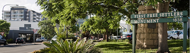
The first permanent European settlement in the area was a mission built in 1838 by German Lutheran missionaries, under the guidance of Reverend Carl Wilhelm Schmidt and later Reverend Christoph Eipper with the aim of bringing Christianity to the local Aboriginal people. They first called the area ‘Zion’, and the mission was located in the vicinity of the modern-day street ‘Walkers Way’. It later became “German Station” and then ‘Nundah’, derived from the Aboriginal name for the area. The explorer Dr. Ludwig Leichhardt visited the area in 1843, and spoke very highly of the mission, but despite this the mission met with limited success and was closed at the behest of the colonial government in 1846. This first settlement is nonetheless commemorated with a monument at the corner of Sandgate Road and Wood Street unveiled in 1938 by the then Premier of Queensland William Forgan Smith. The names of these German settlers can be seen in the names of streets in Nundah and surrounding suburbs such as Rode Road and Gerler Road.
Nundah remained an agricultural area until the 1880s, when the construction of a railway between Brisbane and Sandgate in 1882 resulted in a suburban residential construction boom on Brisbane’s northside. This urban sprawl was also encouraged by the Undue Subdivision of Land Prevention Act 1885, which mandated minimum lot sizes for new urban developments. Nundah became known as a suburb where working-class families could obtain cheap housing on reasonably-sized lots not too far from the city. In 1909, Surrey Street in Nundah became the site of the first public housing dwelling in Queensland. In the early twentieth century, Nundah became a major suburban centre, due to its location on Sandgate Road, one of Brisbane’s busiest arterial roads, and the adjacent Nundah railway station. Sandgate Road and nearby streets were lined with shops, pubs, cinemas and other commercial premises.
Nundah was also the seat of Toombul Shire, which was absorbed into the City of Greater Brisbane in 1925. The Toombul Shire Hall still exists as a community centre. In 1926, George Walker suggested a monument be built to mark the beginnings of Nundah, which was unveiled by the Queensland Governor Sir Leslie Orme Wilson on April 23, 1938 as part of the First Free Settlers’ Centenary Celebrations. This First Free Settlers Monument is listed in the Queensland Heritage Register.
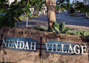
Nundah’s commercial precinct suffered a precipitous decline from the 1970s with the construction of the nearby Westfield Shoppingtown (Later Centro) Toombul shopping centre. Increasing motor traffic along Sandgate Road also reduced Nundah’s appeal as a shopping precinct. However, in recent times a road tunnel has been constructed under nearby Bage Street, diverting through traffic away from the suburban centre. A Brisbane City Council suburban renewal programme has seen new art installations, cafes and commercial enterprises open in Nundah, creating a village-like atmosphere along the now-quiet Sandgate Road.
From: Nundah, Queensland. (2008, August 2). In Wikipedia (http://en.wikipedia.org/wiki/Nundah,_Queensland), The Free Encyclopedia. Retrieved 00:28, August 11, 2008
35 Surrey Street, Nundah
The house built by Otto and Caroline Meissner at 35 Surrey St Nundah has a special significance in Queensland’s pioneering history. The house is significant for its historic associations with the Queensland Government’s incentive in 1909 to provide assistance for the working classes to build and own homes.It is the first property to take advantage of the financial assistance offered under the Worker’s Dwelling Act of 1909 and marks therefore the origins of the present Housing Commission. The house was the prototype of hundreds of dwellings, constructed either under WDS or by speculative builders. The house is a small Queensland timber house on stumps with a corrugated iron roof. Accommodation comprises of four main rooms and a kitchen. The verandah has now been enclosed and much of its early detail is lost.
Cadogan House
Located on Sandgate Road, Cadogan House was opened in December 1933 as Nundah Private Hospital. The hospital was built to accommodate 30 patients in single or double rooms on the ground floor, with the staff being accommodated upstairs.In 1965, the hospital was converted to a medical centre and renamed Cadogan House by paediatrician Dr Newton Chalk. Cadogan House is named after William Cadogan who is recognised as one of the pioneers of paediatrics.
Today, Cadogan House is still being used as a medical centre.
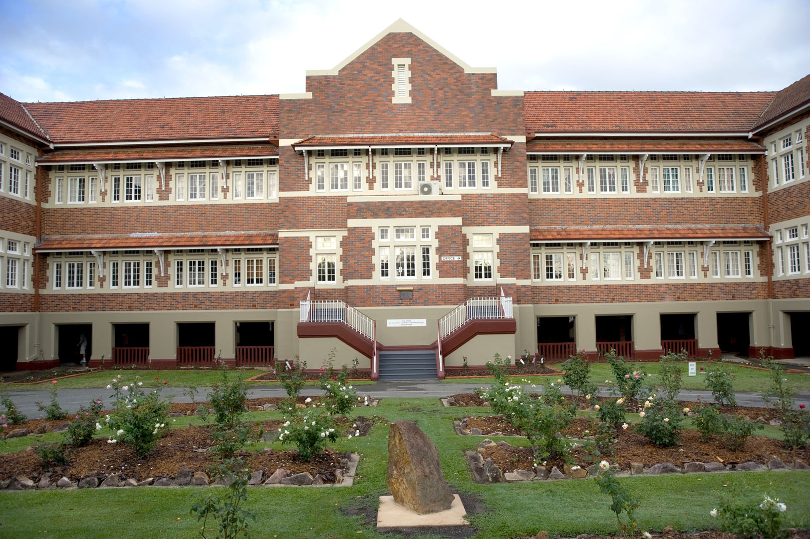
Nundah State School
Located on the corner of Buckland Road and Bage Street, the Nundah State School was opened in October 1865 as the German Station National School with an initial enrolment of 62 pupils. The first head teacher John Nicholson, remained in charge until 1868 and is buried at the Nundah Historic Cemetery.In 1896, the school was renamed Nundah State School. It experienced a period of rapid expansion. In 1912, when the infants’ wing was constructed, 700 pupils attended the school. The northern wing (facing Boyd Road) was erected and opened in 1935. Between 1939 and 1945, trenches were dug in the school grounds to protect its pupils from the possibility of air raids. The main wing of the school was opened in 1941, with the Buckland Road wing being added in 1951. The school pool was built in 1956 and was funded by parents pledging money over a period of two years. The swimming club was established in 1960.
Toombul Shire Hall
1883 the local government division of Toombul was created to serve the needs of the residents of the area. A Divisional Board of directors was elected and the boards offices were situated at Breakfast Creek. In 1890 the Division was split into two, with the new Hamilton Divisional Board taking over the offices at Breakfast Creek and the Toombul Divisional Board were forced to rent premises in Boyd Street Nundah.The Toombul divisional Board became the Toombul shire Council.The Toombul Shire Hall located on Sandgate Road was built in 1890/1891. The Shire was one of 20 local authorities that amalgamated in 1924 to form the Brisbane City Council.The Shire Hall featured offices at the front of the building, with the public hall constructed at the rear of the building. In 1928, a side verandah was added to the building.
The hall features an unusual mix of materials and construction methods. The hall is sheeted with corrugated iron, the offices with chamfer boards, while the front facade incorporates brickwork in two colours. During the Second World War the ARP Civil Defence and the Nundah Auxiliary Ambulance used the building with first aid classes being conducted by the Queensland Ambulance Transport Brigade. In 1987/1988 the Brisbane City Council undertook extensive renovation and restoration work on the hall at a cost of $135,000. the building is listed in both the Queensland Government and Council heritage registers. The Hall is one of two surviving shire halls constructed of timber in the Greater Brisbane area and the only one still owned by the Brisbane City Council.
For more information on Nundah’s history, call the Nundah and Districts Historical Society on (07) 3260 6703.
Toombul Terrace Reserve
This reserve was amalgamated with Hamson Terrace Reserve and Bage Street Reserve. Sections of the parkland have been gained by Council through transfers as gifts during the 1940’s and 1950’s, and during the 1980’s and 1990’s through acquisition. A coal pit was opened in 1906 operated within the steep slope north of Kedron Brook that supplied coal to local industry until the mine closed in 1910. One of the local businesses to use this coal was the Virginia Brick Works near what is now the Virginia Railway Station. During this period 1803 tons of coal had been mined. The mine reopened in 1913 closing again in 1915, then opening briefly in 1929 closing in 1930. Both occasions the mine closed due to depressed coal prices. For safety reasons the mine entrance was filled in. A porphyry cairn was erected in 1989 near the old entrance commemorating the mine. A new steel footbridge was constructed in 1996 replacing the old timber structure at the Toombul Terrace cul de sac.
Toombul Terrace Reserve can be found at the Kedron Brook end of Toombul Terrace, Nundah.